Others (under construction)

Saturday, August 25, 2012

Climbing Pine Tree Hill & Twin Peak Again

This is my 2nd time trekking at the Pine Tree trail. The first time, 3 weeks ago, was a recce for this trip. After the first hike, I wasn't feeling that keen to climb here again so soon. I have this feeling like, oh, I still can back out anytime I want to. So that was what I felt until I had a message from Messner saying that he may not make it for the hike and asked if both my sis and I, together with 2 others could lead the team. I panicked when I saw the message. Immediately I thought of doing another recce before the actual day. It didn't materalised lah, otherwise I would have blogged about it. :D

I won't go into details of this hike as I've covered most of this trail in my last post. You can read it here

So as usual we waited at the Tesco McD, this time at 4.15am. 

There were 24 of us who were supposed to meet here and I thought we wouldn't be able to leave this place on time, but I was wrong. Everyone was early and we pushed off by 4.16am. There were 5 cars from Seremban and all the drivers went at their own speed. Our meeting point was at the Rawang toll where we were supposed to meet up with 2 more hikers. 

Arrived at our usual noodle shop in Kuala Kubu Bahru. With 26 noodle orders, we left this place later than what we had planned. 

At nearly 7AM, we left the noodle shop for Fraser's Hill. Our next and final meeting point was at 7.55AM at the clock tower in Fraser's Hill.

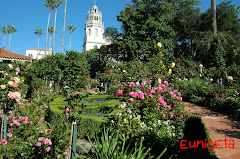
Here's the clock tower. There were other groups from KL who joined us. Edwin, the team leader for this hike, gave a short briefing and off we went on a short drive to the entrance of the trail.

There were more than 10 cars parked at the narrow road leading to the entrance of the trail. 


A group picture minus me.

We started at 8.51AM. It started to drizzle and I was praying very hard for it to stop. I didn't want to discover if there were indeed leeches lurking about in this hill during wet days.

The light drizzle turned into a heavier one and we were forced to wear our raincoats. Some didn't though. They either forgot to bring their raincoats or the drizzle wasn't heavy enough bother them.

I was slower this time because... take a look at the pictures below. :D

My buddy was Jared and he was blasting boyband songs from the 90's out from his ipod. We sang and took a lot of HIS photos. :D

Not even 2 km into the jungle, Jared's shoes gave way. At first he just used wrist and elastic bands to hold the shoe together. It wasn't secure at all because after a minute or two, the bands began to ease out. Later when we reached the 2nd peak, his dad had other ideas, using plastic bag and string but that didn't work out well too. We reminded ourselves to bring duct tapes next time. 

By the time we reached the steep ascend part, it was already 11.52AM. We were very late. I'm sure by now the others have reached the 2nd peak.

12.02PM - We reached the Pine Tree Hill peak. I thought maybe we could stop here and wait for the rest to come down, but Jared said he wanted to go to the 2nd peak too. He ate a packet of his nasi lemak and off we went to the 2nd peak, the Twin Peak.

On our way to Twin Peak, we met a bunch of climbers descending. Seems they were at the peak for 40 minutes already.

12.49PM - Finally reached Twin Peak. Only Edwin and Steve were there. Ban Ming and 2 others came 10 minutes later. 

Jared had his 2nd pack of nasi lemak and his shoes tied again before descending.

Okay, this is where it gets a little bit interesting. We were in a group - Edwin, Steve, Jared and I.
About 10 minutes of walking away from the peak, we heard something which sounded like a whistle and it sounded every 15 seconds or so. Steve looked up and asked, "is that the sound of a whistle?" I listened and said yeah, it did sound like a whistle. Steve called out to Edwin and asked him to listen. Edwin cocked his head and after listening for a while, he concluded it was a bird. I wasn't too sure now because there were other birds calling out to each other too. After walking for 5 or 10 minutes, the whistle sound sounded nearer. We stopped to listen again. Then Edwin brought out his whistle and blew into it. Immediately there was an answering whistle similar to the sound we kept hearing. Edwin called out, "Anyone out there?" And to his surprise, we heard Yvonne's voice shouting back saying that Swee Leng fell into the ravine. We hurried to where she was.

It seems that Swee Leng took the wrong route but only 2 or 3 metres in and she slipped and fell about 10 metres down a ravine. (Later she told me that she used her walking stick to break her fall). With her whistle in her backpack and no way of reaching for it, she called out to Yvonne who was, even though, not far behind but far enough for her not to notice that her friend fell off the trek. Yvonne, thinking that Swee Leng wanted to see something, hurried her steps only to find that her friend had fallen down the ravine. It was then that Yvonne used her own whistle to call for help.

 
So here's Steve and Edwin going down to help Swee Leng. According to Steve, he said that this area had a landslide. As he approached Swee Leng, he found that the earth was soft and slippery. He used a branch to steady himself and helped Swee Leng climb back up. Later he said that there was another 40 metres drop with no roots or branches to hold on to. Swee Leng thought it was about a hundred metres drop. 

So here's Swee Leng climbing up.

Ahhh... the blue wrapper from my previous Pine Tree post. Looks like this spot is spooked. (kidding). Three weeks ago we climbed this hill and got lost around this area and we spotted the blue wrapper. Now Swee Leng went the wrong route and fell even though there was enough paper trail placed at the junction to go up instead of straight.  

2.06PM - Reached the first peak, Pine Tree Hill peak and waited for Ban Meng and 2 other guys.

Going down the steep trail.

This is where I screamed so much. I really don't know how my sister made it without any help. I was like "Ahhhhhhhhhhh..... where to put my feet" and "I don't think I can reach, howwwwwwww?"

Fortunately, there was a young chap who helped me down slowly. :D

Long journey out...


The last 2km out is a sheer torture for me. I was so tired looking up at all the steps ahead of me. My sister text me at 4.14pm saying that she was already at the entrance and I text back saying that I'm at the 2km stairs. 

I only reached the entrance at 5.25pm. Took me more than an hour the last 2 kms because we were ascending most of the time.

We washed up at the public toilet near the food court/playground in Fraser's Hill and went back to Seremban to have dinner. 

There are a few things we learned from this hike : - 

1) Buddy system is very important and make sure you don't abandon your buddy at any time.

2) We should carry a long rope for rescue purposes.

3) Carry a whistle (and torchlight) and wear it in front so that we can reach out for it easily.

4) Brief climbers on a whistling system for easy identification. Eg - 3 short whistles = distress call. 2 long whistles = answering to a distress call. 

5) Carry a duct tape and a knife in case your shoes opens up.

6) Leave papers at every 10 metres or so and leave more  at every junction.


Tuesday, July 31, 2012

Climbing Pine Tree Hill & Twin Peak

A week ago I received a message from Messner asking if I was keen to go on a recce trip to Pine Tree Hill and Twin Peak in Fraser's Hill the following week. I replied with a "Hmm sounds interesting, should be able to make it" message. He planned to lead a big group in August and thought maybe he should recce the climb so that everything would be smooth sailing come the actual day.
Initially he asked only David to accompany him for the recce. Later he must have thought to call my sister and I along as there were enough space in the car plus the fact that it was more fun to hike when there were more people. My thinking is, it's more fun to hike with us twins. Period. :D

So last Saturday my sister and I diligently followed a group up to Gunung Datuk to prepare ourselves for the Fraser's Hill climb. :)

Okay, now for the usual detailed report of the climb. :)

Eh, I better warn you guys, the climb was so nice that I took 700+ pictures. Bear with me, this will be quite a looooong post.

We met at McDonalds at 4.25am and shot off immediately to the highway. Our first destination was breakfast at Kuala Kubu Bahru (KKB). We took the North South Highway (Elite) and exited at Rawang (Exit 116).Then we followed the signboard Ipoh/Kuala Kubu Bahru. As we approached the first turning to KKB town, Messner double checked his GPS. It showed that there was another turning much further up. We followed the GPS and eventually reached KKB town NOT without some wrong turnings. We had a little bit of trouble getting into the town itself. All I could remember was, we had to turn left at the mosque. :D

We picked Matthew, a friend of David's, at KKB and then looked for an interesting looking shop to have our breakfast. 

6.33AM - So here we are, at a noodle shop. The same one we went to when we went for the Chilling falls a few years back. The shop has no name. The noodles were simply delicious. I had won tan mee and teh-xi.

The lady who made our breakfast was quite friendly. We asked her what time she opens her shop and was told that it depended on what time she woke up. Well, that was how I translated it lah, coz she spoke in Hokkien. :D

We were here for 1/2 hour before heading to another restaurant to pack lunch. Well, it was Messner who wanted to have rice for lunch and the noodle shop only sold noodles. (duh!) :D


We a 24-hour mamak restaurant near 7-11.

On the road again. The famous GAP on the way to Fraser's hill is now a one-way-up only.There is another one-way-down only road at the other side of the hill making it easier for all the cars to go up and down the hill whether they like. (Last time, the GAP road was opened every other hour, depending on whether you want to go up or down the hill).


8.19AM - We reached the town Fraser's Hill. It took us roughly about 1 hour from KKB. As we were already behind schedule, I didn't stop to take a pic of the famous clock tower situated at the centre of the town. We headed to a public toilet nearby before heading towards the start of the trail. It cost us 30cents and according to the lady who collected our money, this toilet is open 24 hours. We were here for like 15 minutes!! 


Anyway, we took about 10 minutes to reach the entrance of the trail located near the TM bungalow.
This is the TM bungalow.


We parked near the bungalow and started walking about a hundred meters before we reaching the Pine Tree Trail entrance.

8.52AM - We started our journey. The weather was perfect.

8.53AM - The first hut. 1 minute WALK from the entrance.

Oh-oh, why are we going downhill? WHY?

The 100 meter sign to trail exit.

The 600 meter sign to trail exit.

So many fallen trees.

A hut and the 900 meter sign to trail exit.

Going downhill again. What is this??!!!


..and down and down..


Hmmm... I think we are finally going uphill.

Some weird looking fruit and a hut.

Going up.. yay!

9.30AM - The 1.5km sign.

A broken shelter.

Um.. I think we are going down again. Just imagine how much we'll suffer when we hike back to the entrance.

My sister left me far behind while I was busy taking pictures of David and Matthew.


When I came to this fallen tree, I shouted to my sister, hoping that she was near enough to hear. I asked how did she get the the other side and she replied faintly, "go underneath the tree". She repeated twice and I went underneath the wrong tree trunk. -.-

David and Matthew came along shortly to help me. After that when I shouted to my sister again, there was no answer from her. She was too far to hear my voice.
The trail was easy. We imagined Steve (one of our fellow climbers who is also active in running, diving and cycling) running along this trail.

The stone which marks the Pahang-Selangor border. There were a few of them along this trail.

9.41AM - The 1.8km sign.

More beautiful fallen trees.

I walked alone for a while, but occasionally I could hear David and Matthew's voices which were music to my ears. At the fallen tree, I stopped till they were near enough so that I could take a picture of them with the tree.


10.14AM - The 2.7km sign.

10.21AM - The 3km sign.

Fallen trees.

Water point on my left but I didn't stop to investigate because I saw my sister far ahead. Somewhere along this stretch, my sister and I stopped to eat some fruits.

10.43AM - The 3.9KM sign.

Going up..

The trail is pretty clear.

Going up again..

11.16AM - The 4.8km sign.


11.22AM - The 5.1km sign.
It was after this sign when I heard Messner's voice. I was so excited because we were almost reaching the first peak. I shouted behind to David telling him that we were almost there. He shouted back that he didn't believe me. I told him that I heard Messner's voice and David asked if I was talking to the monkeys instead. Haha. Looks like he was showing signs of AMS. :D


So, as I look ahead for Messner's form, I found that I had to look UP.

I was like WOW...Looking at the steep trail ahead, I wasn't sure I could make it to the top.

Rachel went first. Messner came down halfway to help her.

Then it was my turn. I had to take huge gulps of air just after each step up.

Actually it wasn't that difficult as there were defined landings to place your feet all the way up. I just scared myself by looking at the steepness of the trail and my mind processed it as difficult to climb.

11.37AM - Ahh. we are almost reaching the peak.When you see the the Pine Tree Hill sign, go up a little slope on your left and you are at the peak already.

David's favourite position whenever he reaches the top.

Not much of a view at this peak. Maybe because it was quite misty.

We had some fruits, rested for a while and off we went to the next peak.

11.52AM - Peter, showing the way to the 2nd peak. When you walk down the slope, pass the Pine Tree Hill sign and turn to your left.


Beautiful fallen mossy trees.

Going down...

Going up...

Border stone and easy trail.

Another border stone and lingzhi along the way.

Climbing over the tree trunks and bending under them makes the climb a little more interesting.

12.30AM - Arrived at the Twin Peak.

The twins at Twin Peak.

The view at Twin Peak.

Not much of a space at the peak.
A group pic.

 
Messner had rice while we twins nibbled on pears, bananas and dates.

1.13PM - We left Twin Peak.


If you see this weird looking tree branch, you know that you have taken the wrong way.
We got lost for half an hour. Fortunately, Matthew had a hiker's GPS. He said that we were slightly off course. 


We were so near yet so far. David spotted the blue wrapper when we were at the wrong path. Then when we were at the right path, he spotted the blue wrapper again. The blue wrapper was in between the wrong and the right path.

Messner said we should have looked out for the red & white plastic 'string' tied to the trees along the way.

Continuing our walk again.
We reached Pine Tree Peak at 2.24pm.

Rested for 6 minutes before going down the ropes section again.

Here's a little video of the steepest section of this trail.

3.15PM - at the 3.9km sign where we stopped for a break.

Border stones and paper trails.

Why are we going up again???

4.33PM - 1.8km to the entrance.

4.43PM - 1.5km to the entrance.

Going up the stair again. This is what I hated most when coming out from the hill. Rach and I spotted the 900m sign and thought it was 300m more. So we waited at the hut nearby for the guys. I think they must have stopped to rest just before the long staircase up because we waited for like 10 minutes. While waiting, we ate some fruits to appease our going-to-be hungry stomachs.


5.25PM - The 600m sign. This was when I realised that the 300m sign I saw just before the hut was actually 900m. :(

5.38PM - Another hut and 1 minute later, we arrived at the entrance. We rested a while at the entrance before heading to the public toilets to wash up.

Since it was puasa (fasting) month, there were hardly anyone at Fraser Hill's food garden. The air was getting colder and we decided to have a cup of hot drink at the Chinese coffee shop nearby.

The venue for dinner was already preset by Messner. Through various blogs, he read that there was good food found at Hulu Yam. So we headed there but the restaurant we were looking for was closed, so we went to another restaurant called Restaurant Hoe Kiong Seventy Two.


We had "loh meen" (that's what Hulu Yam's famous for), Mee Hoon, Fish cooked in an interesting style and veggie.

By the time we reached home it was about 11.15pm. What a long day.

Timeline :

About 2 hours from Seremban to KKB town.

1 hour and 10 minutes from KKB town to Fraser's Hills.
2 hours and 45 minutes from the entrance to the Pine Tree Hill peak. 

38 minutes from Pine Tree Hill peak to Twin Peak.

Total time from Entrance to Twin Peak (including rest time at Pine Tree Hill peak)  : 3 hours 38 mins.

Total time from Twin Peak (including 3 breaks and getting lost for 1/2 hour) : 4 hours 26 mins. 

Oh  BTW, remember, I needed more time because I took 700 over pictures during this climb. :D